Connect, Communicate, Collaborate

AcquisCONNECT Mapping Intelligence
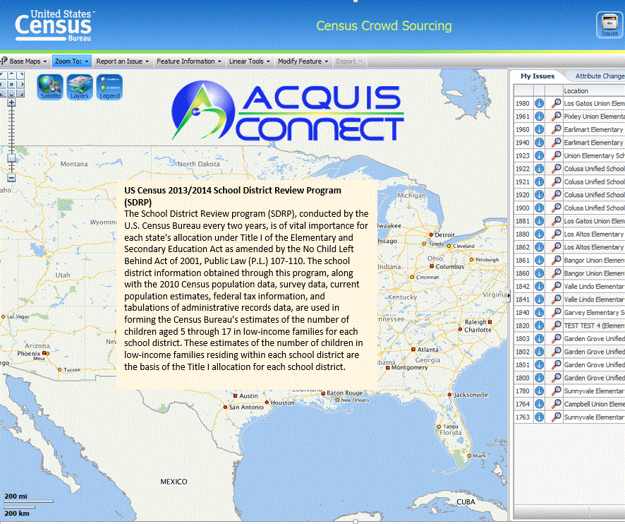
Mapping is an integral part of every government agency, with so many decisions based on mapping intelligence. Isn't it time to enable these agencies to use and provide feedback based on mapping intelligence. AcquisCONNECT's integrated mapping capabilities have the look and feel of any standard GIS without the need for GIS software.
Standard Enterprise Architecture Enables Real-time Enterprise Geospatial Business Intelligence
Standard Java Based Enterprise Solutions
This enterprise java application module enables users of AcquisCONNECT to integrate our map capabilities which include view, edit, query and create mapping features and attribute information associated with other standard IT business information.

Extend The Use of Geospatial Information
The same capabilities that can be used for land management, land use and planning can also be used for connected health applications, sensor based mobile community care applications and rehabilitative health care.
Identity Managed Intelligent Collaboration

Users can visualize existing data sets and provide suggested updates of both annotated information and geospatial map feature changes. This system enables the external participant to see only the map feature layers and associated information that is relevant to them.